Ifold Copse - Lot 6b
Plaistow, Billingshurst, West Sussex, RH14 0QF
Guide Price
£60,000
Residential Tags: N/A
Property Tags: N/A
Land Tags: Woodland
Summary Details
- First Marketed: Oct 2022
- Removed: Date Not Available
- Residential Tags: N/A
- Property Tags: N/A
- Land Tags: Woodland
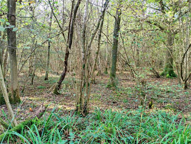
A picturesque parcel of amenity woodland extending to approximately 3.4 acres (1.38 hectares). Situated in a remote location providing a haven for wildlife, nestling in the West Sussex countryside, well away from public roads with Plaistow village closeby.
DESCRIPTION
A beautiful parcel of indigenous, deciduous woodland tucked away in the West Sussex countryside, ideal for private amenity purposes such as family camping or carrying out some woodland crafts. Its remote location provides a haven for wildlife. There is a public bridlepath forming part of the south boundary which offers a short walk to the nearby Plaistow village.
In all approximately 3.4 acres (1.38 hectares).
NB
The land being sold is shown edged red on the attached plan. It has the benefit of a right of access along the track coloured purple.
AMENITIES
Local: Plaistow village is closeby with a church, public house, village stores and primary school.
Towns: Haslemere (approximately 7 miles) with a good range of shops and services. City of Guildford (approximately 14 miles).
Leisure: The land lies in lovely countryside, just outside of the South Downs National Park and has the benefit of local footpaths and bridlepaths for walking and riding.
ADDITIONAL INFORMATION
Local Authority: Chichester District Council, 1 East Pallant, Chichester, West Sussex, PO19 1TY. Telephone: 01243 785166.
Services (not checked or tested): No services connected.
Tenure and Possession: Freehold with vacant possession available on completion. Land Registry Title Number WSX312890 (part).
Rights and Easements: The land is sold subject to and with the benefit of rights, including rights of way, whether public or private, light, support, drainage, water, gas and electricity supplies and any other wayleaves or easements.
Links: www.environment-agency.gov.uk, www.nationalhighways.co.uk, www.caa.co.uk, www.landregistry.gov.uk
Plans and Areas: These are based on the Ordnance Survey and are for reference only. The purchaser shall be deemed to have satisfied himself or herself as to their accuracy and any error or misstatement shall not annul the sale or entitle any party to compensation in respect thereof.
Covenants: The land may be used for commercial forestry and other agricultural purposes only. No other commercial enterprise will be permitted. One agricultural and/or forestry building only (subject to the usual planning permission). A maximum of one dwelling or mobile home only (subject to the usual planning permission). No subdivision. Personal recreational use is permitted.
Marketed by: Batcheller Monkhouse, Pulborough
Land Registry Data
- No historical data found.


